The Saudi Ports Authority (MAWANI) and the General Authority for Survey and Geospatial Information have signed a Memorandum of Cooperation (MoC) with the aim of raising the level of planning for joint works.
The MoC was signed by the President of MAWANI, Omar bin Talal Hariri, and the President of the General Authority for Survey and Geospatial Information, Muhammad bin Yahya Al Sayel, at the headquarters of the General Authority for Ports in Riyadh.
READ: MAWANI docks world’s largest containership
According to MAWANI, the MoC reflects the distinguished partnership between MAWANI and Geospatial, and enhances joint cooperation in exchanging data and technical and technical consultations in common fields, in addition to supporting research, commercial and logistical activities, and developing national economy.
Furthermore, the cooperation seeks to achieve integration between the two parties in the field of benefiting from geospatial data, information and services, by adopting and using the official map of the Kingdom in all ports work, as well as adopting the base maps issued by the Geospatial Authority as an approved official source for borders.
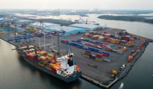
In August, MAWANI announced that its ports achieved an increase in the number of handling containers.
One month later, MAWANI signed an agreement with the Saudi Investment Recycling Company (SIRC) to boost collaboration across sustainability, marine safety, and oil spill control.