An interactive map released by data visualisation and digital journalism studio Kiln, shows global shipping traffic in 2012.
The map highlights shipping movements from a wide-range of ships, including container, dry-bulk and tanker ships.
The map was created by taking data on location and speed of ships and then cross-checking this with another database in order to obtain vessel characteristics.
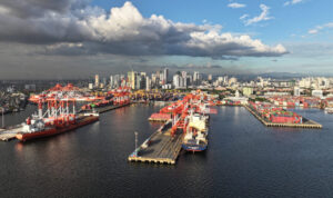
Currently, more than 90% of global trade is carried by sea, with recent data from Drewry showing that new-build capacity is set to swell by 1.3 million TEU in 2016.
Technical Paper: Huge Overcapacity: In Absence of Demand
See below for the global shipping map:

(Source: KILN)