Data by itself has little value unless it is converted into information for intelligent and actionable decision-making in maritime.
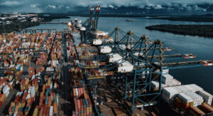
The prodigious number of data sources in maritime that the sector can harness – from vessel cargo composition, to supply chain greenhouse gas emissions, to port authority CCTV footage of port perimeters – requires a level of standardisation, of collaboration and of a single guiding mind.
This was the resounding message of Port Technology International’s Data Analysis and Visualization – The Lighthouse for Maritime Situational Awareness webinar held in partnership with Hexagon Geospatial.
Data in maritime
A plethora of challenges face ports when communicating information with surrounding stakeholders. Whether that be lack of interoperability, lack of standardised definitions for data exchange, or siloed optimisations, data, in all forms, can be transformative but tricky.
However, the industry is ready to meet this challenge.
Hexagon Geospatial, a software solutions provider, leverages all data the maritime sector produces and shares, and provides valuable insight on what has happened at a port; what is happening currently; what could happen; and, through simulation and predictive analysis, what should happen in port operations.
“The decision-making process for any port can be long and complicated,” explained Richard Goodman, EMEA Presales Engineer at Hexagon Geospatial.
“Visualising data can assist the user in situations requiring operative decisions around a port.”
For Goodman and Hexagon Geospatial, that visualisation is key.
Take vessel traffic navigating a port: if provided with the information from vessels and cargo carriers, Hexagon can deliver a real-time, easy-to-read visualisation solution that allows port operations to have wider awareness of anchored vessels, vessels off-route, and vessels outside of a corridor – allowing authorities to predict and prevent issues with shipping ahead of time.
The benefits? Anything ranging from reduced ship turnaround time, to reduced risk of shipping collisions, to reduced greenhouse gas (GHG) emissions due to improved optimization of Just-In-Time (JIT) arrival.
“The geospatial world is on the acquisition and management of data – so the extraction of information from the data is key,” Goodman notes.
“Having the correct tools to analyse data and make actionable decisions is critical to do that.”
Industry trailblazers
Hexagon Geospatial’s innovative solutions provide untold benefits for the sector. But where else is data collaboration providing an impact?
The Hamburg Vessel Coordination Centre (HVCC) is a clear example of a port working collaboratively in the community. Developing a single software platform taking in a multitude of data sources, HVCC has coordinated a staggering 7,400 feeder and terminal calls since 2019.
“We receive data from many partners like Automatic Identification Systems (AIS), terminals, carriers, authorities, and previous and next ports like the Port of Rotterdam,” said Gerald Hirt, Managing Director at HVCC.
“We put all of this data into context, and then we have new operational situational awareness provided to all users.”
Like Hexagon, Hirt stressed the importance of visualized data for users, allowing all stakeholders to benefit.
SEAPort Solutions at the Port of Valencia exemplifies the benefits of reducing those tempestuous issues of siloed departments, inconsistent data sharing, and lack of transparency in maritime.
With its PAULA platform, real-time data is exchanged on one system, flexible and scalable for each port. PAULA automatically links the variety of agents at Valenciaport during a port call process to each other for ship-to-port communication services.
“Agents have to be properly internally coordinated for JIT arrival,” explained Gabriel Ferrús Clari, CEO at SEAPort Solutions. “Otherwise, the agents involved in the processes will not be able to provide accurate time of arrival.”
The platform is based on consensus KPIs and targets for that specific user.
“You can’t manage what you don’t measure,” Clari said. Assessing agent coordination against JIT arrival performance can provide incredible value for the whole shipping chain, including a saving of €675 ($795) per port call for shippers, and a reduction of 452KG of CO2 emitted per ship call.
The competition debate
An intriguing question posed to the panel during the webinar was that of commercially-sensitive data sharing between competitive actors in maritime – rival terminals and carriers’ cargo compositions and shipping schedules could be leveraged by competitors to acquire customers, for example.
SEAPort Solutions has already sought to square this circle, operating an access management model, where permissions are in place for the right stakeholders to access data that solely they need.
But in terms of a cultural shift? A slow, step-by-step approach to sharing data might be the key, argues Marcel van de Pol, Programme Director at the Digital Container Shipping Association (DCSA).
“I see a lack of trust between carriers and terminals,” Van de Pol told the audience.
“Looking at it from the outside, with that I do not see a lot of merit. This is a lot about change management. We used to work in a certain way, but if we want to achieve what we want to achieve in the industry, then we need to stop doing it and look for new ways.
“The approach moving forward should be yes, we have data, and yes, we can share. It might hurt us a bit here, but it will allow us to gain much more overall.”